Titel
'Physical map of the World’, 1849.
Caption
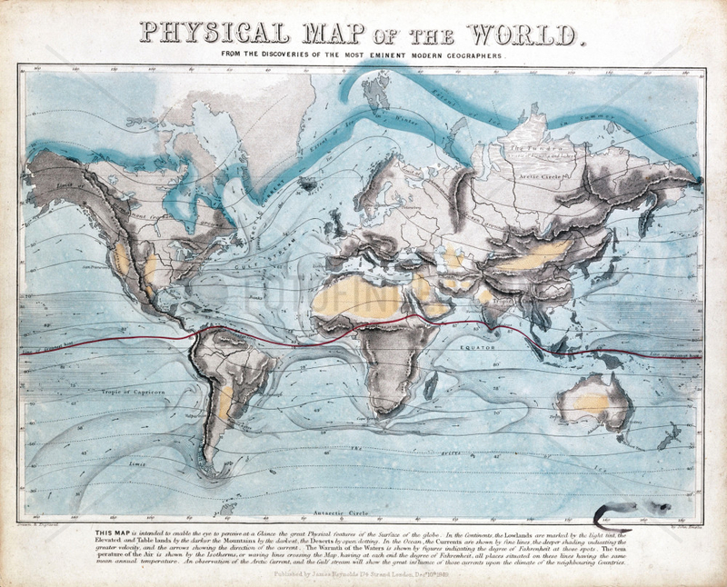
One of a set of teaching cards published by James Reynolds & Sons, London, England in 1849. Titled 'Physical Map of the World', the chart was drawn and engraved by John Emslie. It shows the distribution of mountain ranges, deserts and the seasonal range of the Earth's icecaps. In addition global ocean currents are shown along with air and sea temperatures around the world., 7023568
Aufnahmedatum
01.01.2009
Bildnachweis
Science & Society / FOTOFINDER.COM
Bildname
10325820
Bildgröße
3504px x 2827px, 29,70 cm x 23,90 cm (300 dpi)
Model Release
Kein Model Release vorhanden
Property Release
Nicht spezifiziert
Mehr Infos Weniger Infos
Land
United Kingdom
Bildanbieter
© Science & Society / FOTOFINDER.COM - Veroeffentlichung nur gegen Honorar, Urhebervermerk und Belegexemplar an FOTOFINDER.COM @ Ali Paczensky e.K., Buelowstr. 27, 10783 Berlin. Hinweis: NO MODEL-RELEASE! Bei werblicher Nutzung vorher Kontakt aufnehmen via E-Mail: info@fotofinder.com, Telefon: +49 (0)30 9150 0486. Ueberweisung des Honorars erfolgt an: FOTOFINDER.COM e.K., Deutsche Bank IBAN: DE64 1007 0024 0461 7700 00, BIC: DEUTDEDBBER.
Fotofinder.com Bildnummer
7023568
/ 667F0455F7DF59BB
Stichworte Stichworte
Reynolds
, Viktorianer
, abbilden
, arktisch
, bergketten
, eis
, erde
, erden
, erdkreis
, erdkunde
, erdteil
, festland
, gebirgsketten
, gebirgszuege
, geografie
, industrielle revolution (1780-1869)
, james
, komprimieren
, kontinent
, masse
, meeresstroemung
, natuerliche umgebung
, natur
, ow_science-society
, ozeane
, physikalische geografie
, planeten
, pmscartandhistory
, pmscinternational
, soehne
, sonnensystem
, temperatur
, temperaturangabe
, verzeichnis
, viktorianisch
, waerme
, welt
, wuesten
Nutzung anfragen
Beratung per Telefon:
+49 30 9150 0486
Montag - Freitag 09:00 bis 18:00 (MEZ)
Montag - Freitag 09:00 bis 18:00 (MEZ)